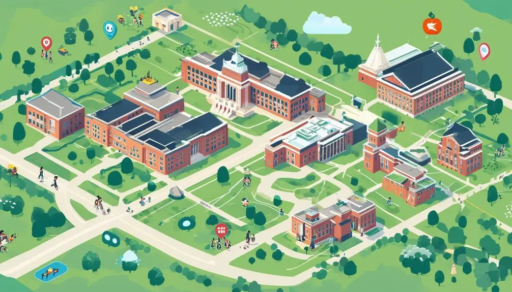
Improve campus navigation with interactive maps featuring live location tracking, detailed building information, and personalized navigation options. You can pinpoint exact locations, navigate effectively, and receive current directions. Live parking availability minimizes search time, while tailored searches enable you to swiftly locate specific facilities. Virtual reality scenes offer immersive tours, and GPS-enabled guidance guarantees you never lose your way. Multimedia components such as high-quality images and panoramic views enhance your experience. Real-time data updates keep you updated on events, traffic, and construction, ensuring smooth navigation. By utilizing these functionalities, you can make the most of the interactive campus map.
Key Takeaways
- Real-time location tracking allows for precise navigation through buildings and facilities.
- Directions adapt to real-time changes, providing accurate and seamless navigation.
- Search functionality quickly locates specific facilities, dining options, and parking areas.
- Customizable maps highlight user-specific preferences and relevant points of interest.
- Live data updates offer immediate insights into parking availability, traffic, and campus events.
Real-Time Location Tracking
Real-time location tracking on interactive campus maps allows you to pinpoint your precise location and navigate through the university’s buildings and facilities with accuracy. By leveraging this technology, you can track your movement in real-time, making it simpler to find your way around the campus. This is particularly advantageous for visitors, students, and staff who need to efficiently locate specific areas.
Interactive campus maps equipped with real-time location tracking provide a dynamic and responsive user experience. As you move, the map updates continuously, reflecting your current position. This feature is not only convenient but also enhances safety and security by providing precise location data during emergencies. For example, if you need to meet someone quickly or report an incident, you can share your precise coordinates.
Additionally, real-time location tracking helps you locate amenities or services on campus without difficulty. Whether you’re searching for a library, cafeteria, or restroom, the map can guide you directly to it. The precision of pinpointing your location guarantees that you spend less time wandering and more time focusing on your tasks, thereby enhancing your overall campus experience.
Building Information and Directions

Interactive campus maps provide extensive building information, detailing names, functions, and amenities to guarantee you navigate the university with ease. These maps are designed to give you quick access to essential details like building names, their respective functions, and the amenities they offer. You’ll find operating hours, contact details, and even accessibility features clearly listed, ensuring you have all the information you need at your fingertips.
When it comes to getting directions, interactive maps excel in customization. You can input your starting point and receive tailored directions based on your preferred mode of transportation, whether it’s walking, cycling, or driving. This ensures you reach your destination using the most efficient route possible. The directions are precise and adapt to real-time changes, offering a seamless navigation experience across the campus.
The utility of these interactive maps is further enhanced by their ability to provide up-to-date building information, minimizing the time you spend searching for specific facilities. By integrating detailed building information and customized directions, interactive maps greatly enhance your ability to navigate and utilize the campus effectively.
Parking Locations and Availability

With real-time updates on parking locations and availability, you’ll effortlessly locate the most convenient spots on campus. The interactive map platform provides an essential tool for finding your way through the often crowded university parking lots. By leveraging real-time updates, you can quickly identify open spaces and avoid the frustration of circling the campus in search of parking.
The interactive map platform’s parking information includes key details such as lot capacities, restrictions, and current availability. This guarantees you’re not only locating a spot but also adhering to campus rules. Consider these features:
- Real-Time Data: The map provides up-to-the-minute information on parking availability, reducing time spent looking for a spot.
- Capacity Indicators: Each parking area shows its maximum capacity and current occupancy, helping you decide the best place to park.
- Restricted Zones: Highlighted areas indicate parking restrictions, so you don’t accidentally park in faculty-only or reserved spots.
- Guidance Assistance: The platform directs you to the nearest available parking based on real-time data, ensuring a smooth arrival.
Searching for Specific Facilities

When you use the search functionality on an interactive campus map, you can quickly locate specific facilities like buildings, parking areas, and dining options. The map allows you to customize your search by filtering results based on your preferences and needs. This feature enhances navigation efficiency, providing detailed information about each facility to save you time.
Facility Search Functionality
The facility search feature empowers users to pinpoint specific buildings, amenities, and services on the campus map with precision and ease. Through this function, you can efficiently navigate the campus by locating academic buildings, dining halls, parking areas, and recreational facilities. The search capability within an interactive map ensures that visitors find necessary facilities quickly, thereby enhancing their navigation experience to a great extent.
To enhance user convenience, the facility search includes filters and categories, allowing you to narrow down your search results based on specific preferences. This streamlined approach not only saves time but also reduces the frustration of wandering around looking for a particular place.
Here’s how the facility search feature can benefit you:
- Efficient Navigation: Quickly find essential facilities like academic buildings and dining halls.
- Custom Filters: Use filters to narrow down search results, making it easier to find exactly what you need.
- Improved User Experience: Enjoy a streamlined and hassle-free way to locate various campus amenities.
- Time-Saving: Spend less time searching and more time focusing on your activities.
User Customization Options
By leveraging user customization options, you can filter and refine your search for specific facilities on the interactive campus map, tailoring the results to meet your unique preferences and needs. This feature lets you input keywords or categories, enabling a swift search for particular buildings, services, or resources. As a result, the customized search enhances your experience by providing targeted results, facilitating efficient navigation across the campus.
Interactive mapping tools within campus maps offer various customization options, which are designed to cater to individual preferences and secure a personalized, user-friendly experience. Here’s how these features break down:
| Feature | Description |
|---|---|
| Keyword Search | Enter specific terms to locate exact facilities, like ‘gym’ or ‘library’. |
| Category Filters | Select categories like ‘dining’, ‘study areas’, or ‘labs’ to narrow results. |
| Personalized Settings | Save your preferences for quicker access in future searches. |
Customization for Personalized Experience
You can enhance your experience by customizing the map to reflect your specific preferences, such as selecting particular facilities or resources. This tailored navigation option allows you to filter information, ensuring you only see what’s relevant to your needs. By focusing on user-specific preferences, these features make your navigation more efficient and personalized.
User-Specific Preferences
Interactive campus maps offer robust customization options, allowing you to tailor the display to your specific needs and preferences. By utilizing these interactive maps, you can easily explore the features of your campus through virtual tours and focus on areas most relevant to you.
To maximize the benefits of user-specific preferences, consider the following customization options:
- Category Selection: Choose between various categories such as academic buildings, parking lots, dining areas, and recreational facilities to personalize your map experience.
- Points of Interest: Highlight specific facilities and amenities that are essential for your visit, making sure you don’t miss important locations.
- Filter Application: Apply filters to access information quickly, streamlining your navigation and making it more efficient.
- Virtual Tours: Engage in virtual tours to familiarize yourself with the campus layout before setting foot on the grounds.
These features make interactive maps incredibly user-friendly. By focusing on areas of interest and filtering out unnecessary information, you enhance your overall campus exploration experience. Whether you’re a prospective student, a visitor, or a staff member, these customizable options guarantee that the map is tailored to your specific requirements, improving your wayfinding and engagement with the campus environment.
Tailored Navigation Options
Tailored navigation options on interactive campus maps let you pinpoint exactly what you need, streamlining your journey through the university. By customizing your map display, you can highlight specific facilities, amenities, or points of interest that are most relevant to you. This level of personalization guarantees that your experience on campus is efficient and engaging.
Interactive maps with tailored navigation options enhance user engagement by allowing you to create a map that suits your individual needs and interests. For instance, if you’re interested in finding the nearest library, gym, or dining hall, you can adjust the map settings to show only these locations. This targeted approach saves you time and effort by eliminating irrelevant information.
Personalization features on interactive maps make campus exploration more intuitive. Whether you’re a new student, a visitor, or a faculty member, these customization options help you navigate the university effectively. You can effortlessly locate classrooms, administrative offices, or event venues, certifying you never miss an important appointment or activity.
Virtual Reality Scenes

Virtual reality scenes offered by CampusTours provide an immersive and interactive way to explore university campuses, enhancing the visitor experience through detailed and engaging virtual tours. These virtual reality (VR) scenes are designed to simulate real-life campus environments, allowing you to navigate through buildings and facilities as if you were physically there. The immersive quality of VR enables you to engage deeply with the campus layout, architecture, and amenities, all from the comfort of your own space.
Utilizing VR, CampusTours supports various viewers to ensure optimal engagement, be it through a desktop, mobile device, or specialized VR headset. This versatility ensures that you can access these interactive tours regardless of your tech setup. Here’s why VR scenes are transforming the way prospective students and visitors experience campuses:
- Detailed Exploration: Explore every nook and cranny of the campus, from dorm rooms to lecture halls, with high-definition imagery.
- Engagement: The interactive elements allow you to click on specific features for more information, making the tour highly captivating.
- Accessibility: Available on multiple platforms, guaranteeing everyone can participate in the tour.
- Realism: Provides a near-physical experience that traditional maps and photos can’t match.
Incorporating these advanced features, CampusTours’ virtual reality scenes set a new standard for campus exploration.
GPS-Enabled Navigation
GPS-enabled navigation on campus maps transforms the way visitors find and access facilities in real-time, enhancing their overall experience with pinpoint accuracy and ease. By integrating GPS-enabled navigation into interactive maps, you can effortlessly pinpoint your location and receive real-time directions to your desired destination. This technology leverages geo-location features to provide precise, location-based information, guaranteeing you’re always on the right path.
When using a smartphone or tablet, GPS-enabled navigation allows you to find nearby points of interest, such as lecture halls, libraries, and dining facilities, without any hassle. The interactive maps are designed to update dynamically, notifying you of nearby amenities and facilities, thereby optimizing your navigation process. This cutting-edge technology enables you to navigate the campus intuitively, reducing the likelihood of getting lost and saving valuable time.
GPS-equipped interactive maps enhance your overall campus experience by offering accurate and reliable information. They ensure you can easily navigate complex campus layouts, locate buildings, and access facilities with minimal effort. This seamless integration of GPS features into interactive maps provides a robust solution for efficient campus navigation, making your visit both productive and enjoyable.
Multimedia Elements Integration

By incorporating multimedia elements like videos, photos, and 360-degree content into interactive campus maps, universities can greatly enhance user engagement and provide a richer, more informative navigation experience. Multimedia elements integration transforms static maps into dynamic tools that facilitate better exploration and understanding of campus layouts.
Here are four key ways multimedia elements integration can enhance interactive campus maps:
- Virtual Tours: Users can begin virtual tours that include high-resolution video footage and photospheres, making it easier to visualize campus amenities and facilities.
- Media Embeds: Embedding photos and videos directly into map markers allows users to get a visual preview of various campus highlights, such as lecture halls, libraries, and recreational centers.
- 360-degree Content: Immersive 360-degree content provides a detailed view of specific areas, helping prospective students and visitors feel like they are physically present.
- Audio Features: Adding audio narrations or soundscapes to specific points of interest can further enrich the user experience, offering a more detailed and engaging exploration.
Integrating these multimedia elements into interactive campus maps not only makes navigation more intuitive but also showcases campus highlights effectively, ensuring users receive a well-rounded and informative experience.
Live Data Updates
In addition to multimedia enhancements, interactive campus maps can greatly enhance user experience by integrating live data updates and providing real-time information on parking availability, traffic conditions, and construction areas. By incorporating live data feeds, your interactive map becomes a dynamic tool that offers users up-to-date information, improving their navigation and planning efforts.
Real-time updates can greatly benefit users by providing immediate insights into campus events, emergency alerts, and building maintenance schedules. For example, if there’s a sudden change in traffic flow due to an event or construction, users can adjust their routes accordingly. This level of detail ensures that everyone on campus, from students to visitors, has access to the most recent information.
Integrating live webcams into your interactive map allows users to receive visual, real-time updates on various campus areas. This feature can be particularly valuable during peak traffic periods or emergencies, providing an extra layer of situational awareness. By utilizing these technologies, you not only enhance user engagement but also guarantee that everyone on campus is well-informed and able to navigate effectively. Implementing these live data feeds transforms your campus map into a detailed, up-to-date resource.
Conclusion
To sum up, harnessing interactive map features for university campuses transforms your navigation experience into a seamless journey. Imagine the campus as a well-oiled machine, where real-time location tracking, GPS-enabled navigation, and live data updates are the gears that keep everything running smoothly. With customization, multimedia integration, and virtual reality scenes, these maps offer a personalized, intuitive experience that’s second to none. Embrace these tools, and you’ll never feel lost on campus again.
Frequently Asked Questions
What Are the Features of Interactive Map?
You’ll find features like real-time location tracking, building information, searchable facilities, parking availability, and customization options. They also include multimedia elements, safety information, emergency contacts, and event details, ensuring a detailed and personalized navigation experience.
Why Are Campus Maps Important?
Campus maps are the lifeblood of university navigation, ensuring you can find buildings, amenities, and landmarks effortlessly. They enhance wayfinding, promote engagement, improve safety, and create a welcoming atmosphere by providing easy access to important information.
What Is the Difference Between a Static Map and an Interactive Map?
A static map is a fixed image, offering no user interaction. In contrast, an interactive map lets you engage with features like real-time tracking, live updates, and multimedia elements, providing a dynamic and customizable experience.


