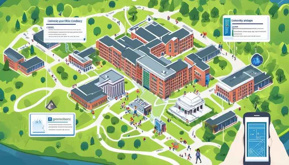
Creating interactive campus maps involves leveraging tools like Mapbox or ArcGIS StoryMaps to integrate real-time data and advanced spatial analysis. You’ll need to categorize amenities and use customizable map options for personalized navigation. Highlight key locations with high-quality visuals and embed multimedia elements to boost engagement. Implement interactive features like trivia and 360° content for an immersive experience. Regularly update your map with user feedback and real-time statistics to maintain accuracy. Use organized filters and detailed spatial data to support wayfinding and event navigation. Explore further for a detailed guide on enhancing map utility.
Key Takeaways
- Choose a mapping software such as Mapbox, ArcGIS StoryMaps, or Google Maps to create an interactive campus map.
- Integrate real-time data to highlight key campus locations and events for accurate navigation.
- Incorporate multimedia elements like photos, videos, and 360° content for a dynamic and immersive experience.
- Customize interactive elements, including colors, icons, and markers, to reflect the university’s branding and identity.
- Regularly update and maintain the map using user feedback, analytics, and real-time data feeds for accuracy and reliability.
Benefits of Interactive Campus Maps

Interactive campus maps greatly enhance both engagement and storytelling for universities by providing precise, data-driven navigation and communication solutions. When you implement interactive campus maps, you’re able to boost user engagement significantly. These maps offer an intuitive, user-friendly interface that attracts prospective students, faculty, and visitors, providing them with a seamless navigation experience. By integrating real-time data, these maps can dynamically highlight key campus locations, upcoming events, and essential services, thereby improving overall communication.
The spatial analysis capabilities of interactive maps enable you to offer detailed and accurate navigation paths. You’ll find that these maps can direct users to specific buildings, classrooms, or facilities with ease, thereby reducing confusion and time spent searching. This precise navigation is particularly beneficial during large events like orientation or graduation ceremonies.
Interactive campus maps serve as a powerful storytelling tool. You can embed multimedia elements such as videos, images, and descriptions to enrich the user’s experience, making campus tours more engaging. The ability to update information in real-time ensures that communication remains current and relevant, further enhancing user trust and satisfaction. By leveraging interactive campus maps, you’re not just providing directions; you’re creating a thorough, engaging narrative of your university.
Key Features to Include
To maximize the usefulness of your interactive campus map, you should integrate features like immersive photos, videos, and 360° content to deeply engage users. These elements create a visually appealing experience and provide a thorough understanding of the campus environment. When designing your map, consider the following key features:
- Organized Categories and Filters: Users need an efficient way to navigate through campus amenities. Categorize buildings, dining options, and recreational areas, and allow users to filter based on their interests. This guarantees a user-friendly experience.
- Highlight Popular Spaces: Showcase notable campus locations and unique features. This helps visitors quickly identify must-see areas and enhances their overall tour experience.
- Customizable Map Options: Offer users the ability to personalize their map experience. Let them save favorite spots, create custom routes, and adjust settings according to their preferences. This level of personalization fosters a sense of ownership and enhances engagement.
- Interactive Elements: Add trivia, fun facts, and other engaging content throughout the map. These interactive components make the tour more enjoyable and informative, especially for prospective students and first-time visitors.
Popular Use Cases

You can leverage interactive campus maps for immersive virtual tours, boosting prospective student engagement through photos, videos, and 360° content. By categorizing campus amenities and using filters, these maps streamline navigation and enhance user experience. Additionally, integrating event and wayfinding support helps users effectively locate venues and navigate between different campus locations.
Immersive Virtual Tours
Immersive virtual tours, enhanced by photos, videos, and 360° content, play a significant role in influencing 62% of students to ponder enrolling in a university. By integrating these immersive experiences, you can offer prospective students a detailed and engaging view of your campus. Virtual tours provide a unique opportunity to showcase campus amenities, leveraging interactive features to create a compelling narrative.
Ponder these data-driven benefits when creating your virtual tour:
- Increased Engagement: High-quality photos and videos capture attention, making it easier for students to visualize themselves on campus.
- Enhanced Navigation: 360° content allows users to explore spaces from multiple angles, offering a realistic sense of the environment.
- Personalized Experiences: Interactive features, such as clickable hotspots and informative pop-ups, help students discover specific campus amenities relevant to their interests.
- Broader Reach: Virtual tours are accessible from anywhere, providing opportunities for international students to explore your campus without traveling.
Implementing these features ensures that your virtual tour is not just informative but also a powerful tool to influence enrollment decisions. By focusing on immersive experiences, you can effectively highlight what makes your campus unique, ultimately driving more prospective students to ponder your institution.
Campus Amenities Organization
Efficiently organizing campus amenities into specific categories like dining, parking, libraries, and offices can greatly enhance user navigation and overall experience. By utilizing filters, you can help visitors easily locate amenities based on their preferences and needs. This targeted method guarantees that users can quickly find what they’re seeking without unnecessary searching.
Creating specialized maps focusing on unique campus features, such as athletic facilities, provides detailed information that can be invaluable for visitors. Highlighting popular campus spaces through these specialized maps not only enhances the user experience but also guides visitors effectively.
Here’s how you can categorize and arrange campus amenities:
| Category | Examples |
|---|---|
| Dining | Cafeterias, coffee shops, food courts |
| Parking | Visitor parking, student parking lots |
| Libraries | Main Library, specialized libraries |
| Offices | Administrative offices, faculty offices |
| Athletic Facilities | Gyms, swimming pools, sports fields |
Incorporate photos, videos, and 360° content to create an immersive campus tour experience. This multimedia approach allows users to virtually explore the campus, making it easier for them to recognize and locate amenities when they visit in person. By leveraging data-driven spatial analysis, you can design an interactive map that meets visitors’ needs and enhances their overall campus experience.
Event and Wayfinding Support
Building on the organized structure of campus amenities, interactive maps greatly enhance wayfinding and event support for students, parents, visitors, and alumni. When it comes to major events like Homecoming and Commencement, campus maps simplify the navigation process and guarantee everyone can find their destination efficiently. By integrating event-specific map layers, you can highlight key locations and activities tailored to specific audiences.
Professors can utilize these interactive campus maps to guide guests to precise locations, making it easier for attendees to focus on the event rather than getting lost. Event-specific map layers can also spotlight campus-sponsored activities and available housing options, enhancing both visibility and planning.
Consider these benefits to evoke a positive experience:
- Customized Tour Stops: Tailor the map to create personalized tour stops with detailed descriptions.
- Enhanced Event Navigation: Use event-specific map layers for clear, concise directions.
- Efficient Wayfinding Support: Help everyone find their way without any trouble, maximizing their event enjoyment.
- Comprehensive Event Planning: Easily view and plan around campus-sponsored activities and housing.
Virtual Campus Tours
Virtual campus tours leverage a combination of photos, videos, and 360° content to provide prospective students with a thorough and immersive view of the campus environment. By integrating interactive mapping and 360° content, you can create a virtual campus that offers an immersive experience, allowing students to explore various locations as if they were physically there. This method not only enhances spatial understanding but also engages users through dynamic visuals and interactive elements.
Incorporating trivia and fun facts can further enrich the virtual campus experience. By strategically placing these elements within the tour, you can keep visitors engaged and provide additional context about the campus. Additionally, organizing campus amenities with categories and filters ensures efficient navigation. Users can easily locate dining halls, parking areas, libraries, and administrative offices, enhancing their overall experience.
Highlighting key campus features such as athletic facilities is another essential aspect. These elements can be showcased through high-quality videos and 360° content, providing a detailed spatial analysis that can attract and engage prospective students. By meticulously planning and implementing these features, you can create a compelling and data-driven virtual campus tour that offers a detailed view of your institution.
Highlighting Campus Spaces

To effectively guide visitors, spotlight popular campus spaces like libraries, dining areas, and athletic facilities using interactive elements and detailed spatial analysis. Start by identifying key campus spaces that play a significant role in daily student life. Use interactive maps to showcase these areas, integrating virtual tours with photos, videos, and 360° content to provide an immersive experience.
Incorporate categories and filters to help users navigate campus spaces efficiently. This data-driven approach guarantees visitors can easily find the amenities they need. Consider creating specialized maps tailored to specific audiences, such as prospective students or visiting athletes, focusing on the unique aspects of each campus space.
Here’s how you can evoke a sense of engagement and utility through interactive maps:
- Highlight Libraries: Showcase study areas, special collections, and tech labs to underline their academic significance.
- Feature Dining Areas: Use high-quality images and menus to present dining options, including dietary accommodations.
- Promote Athletic Facilities: Display workout areas, sports fields, and schedules to allure fitness enthusiasts.
- Organize Campus Amenities: Utilize filters for quick access to restrooms, parking, and emergency services, enhancing overall navigation.
Tools for Creating Maps

When creating interactive campus maps, leverage tools like Mapbox, ArcGIS StoryMaps, Google Maps, StoryMapJS, and Visme to guarantee precision and enhance user engagement. Each of these mapping software options brings unique strengths to the table, facilitating the creation of accurate and engaging maps for your university campus.
Mapbox stands out with its Smart Directions API and GL JS functions, allowing you to develop custom maps tailored specifically to your campus’s layout and needs. ArcGIS StoryMaps excels in handling large datasets and cloud storage, enabling you to create detailed and data-rich interactive maps that can be easily updated and shared.
Google Maps offers real-time editing capabilities and an extensive tutorial library, making it a go-to choice for those seeking a user-friendly experience in map creation. StoryMapJS integrates multimedia storytelling, allowing you to enrich your maps with various media sources, perfect for a dynamic and interactive campus tour.
Visme allows for color-coding and the inclusion of population statistics, enhancing the visual appeal and functionality of your maps. By choosing the right tool, you can harness these customization options to create interactive maps that meet the specific needs of your university campus.
Customization Options

When customizing your interactive campus map, you can integrate branding and identity elements to align with your institution’s aesthetics. Personalize interactive features such as points, lines, and polygons to reflect brand colors, enhancing spatial analysis. Additionally, manage media content by tailoring data points, overlays, and statistics to meet specific requirements.
Branding and Identity Integration
Integrating the university’s branding elements—such as colors, logos, and fonts—into the interactive campus map is vital for creating a cohesive and immersive user experience. Leveraging university branding within campus map customization is not just about aesthetics; it’s about creating a unified visual identity that reinforces the institution’s image and values. By tailoring interactive elements to reflect the university’s unique style and messaging, you guarantee that users immediately recognize and resonate with the campus environment.
To achieve this, consider the following data-driven strategies:
- Use University Colors: Implementing the institution’s color palette in map elements, like icons and markers, will establish a seamless link between the map and other branded materials.
- Incorporate Logos and Fonts: Consistently using the university’s logos and fonts throughout the map will enhance brand recognition and trust.
- Customize Interactive Elements: Tailor labels and markers to match the university’s visual identity, ensuring a consistent user experience.
- Enhance Visual Representation: Employ branding options to deliver a cohesive and visually appealing map that mirrors the university’s image and values.
Interactive Elements Personalization
Personalizing interactive campus maps involves customizing colors, icons, and markers to align with institutional branding, guaranteeing a tailored and engaging user experience. By leveraging personalization options, you can configure interactive maps to reflect your institution’s unique identity. Adjusting colors and design elements to match your branding guidelines creates a cohesive visual experience that resonates with users.
Utilize customization features to modify points, lines, and polygons, allowing you to highlight significant locations and paths on campus. This spatial analysis can enhance navigation and secure users find key areas effortlessly. Introducing custom icons and markers not only reinforces branding but also improves the map’s readability and functionality.
Interactive maps offer various personalization options, including the ability to add custom layers. By doing so, you can emphasize specific zones or buildings, providing a tailored navigation experience that meets diverse user needs. Customization features like these are essential for boosting user engagement and guaranteeing that the interactive elements are both functional and aesthetically pleasing.
Media Content Management
Enhancing user participation further, Media Content Management allows you to embed images, videos, and 360° content directly into the interactive campus maps for a richer spatial experience. Leveraging advanced mapping software, you can seamlessly integrate multimedia elements, making your campus map not only informative but also visually enthralling.
A streamlined media library management system simplifies the organization and retrieval of your media assets. This system guarantees that all your images, videos, and 360° content are easily accessible and can be efficiently embedded into the map. By utilizing branding options, you can tailor the map to reflect your institution’s identity, creating a harmonious and professional look.
To maximize user participation, consider these essential steps:
- Embed Multimedia: Incorporate images, videos, and 360° tours to provide a detailed spatial experience.
- Organize Media Efficiently: Use a media library management system to manage and quickly access your media content.
- Customize Branding: Apply your institution’s branding options to ensure the map aligns with your visual identity.
- Streamline Content Management: Utilize intuitive media content customization features to simplify updates and maintenance.
Enhancing User Experience

By incorporating drag-and-zoom features, interactive campus maps allow users to navigate the campus with ease and precision. These maps enhance user experience by providing a seamless and engaging experience, especially when exploring campus amenities. Interactive maps equipped with data points, overlays, and real-time statistics offer valuable insights into the campus environment, helping users locate facilities, dining options, and academic buildings efficiently.
Implement customization options for points, lines, and polygons to guarantee the map aligns with your institution’s branding and design standards. This level of detail not only elevates the visual appeal but also aids in spatial analysis, giving users a precise understanding of campus layout. Real-time data integration can further boost user satisfaction by offering up-to-date information on events, schedules, and availability of resources.
User-friendly design elements, such as intuitive icons and clear legend markers, contribute significantly to an engaging experience. By focusing on these aspects, you’ll create an interactive map that’s both functional and visually appealing. This all-encompassing approach ensures that visitors can navigate the campus efficiently, fostering a positive and memorable experience.
Maintaining and Updating Maps

Regular maintenance and timely updates are essential to guarantee the campus map remains accurate and reliable for all users. As a University, keeping your campus maps current with the latest changes in buildings, amenities, and facilities is critical. Real-time data feeds can be incorporated for dynamic information on events, construction, and campus features, adding an extra layer of utility and accuracy.
A data-driven approach to maintaining and updating maps involves several pivotal steps:
- Incorporate User Feedback: Regularly collect and analyze user feedback to pinpoint areas for improvement and assure the map meets the needs of the campus community.
- Real-Time Data Feeds: Utilize real-time data feeds to provide up-to-date information on campus events, construction zones, and temporary changes, guaranteeing users always have the latest data.
- Scheduled Maintenance: Implement a systematic maintenance schedule to review and verify map data consistently, addressing any inaccuracies or updates promptly.
- Analytics and Spatial Analysis: Leverage analytics and spatial analysis to monitor map usage patterns, optimize layout and features, and enhance overall user experience.
Conclusion
By weaving together the benefits, key features, and use cases of interactive campus maps, you’ll craft a tool that’s not just a map but a living, breathing guide. Leverage advanced tools and customization options to enhance the user experience, ensuring your map remains a beacon of information. With diligent maintenance, your map will stand the test of time, serving as the digital heartbeat of your campus, guiding users with precision and ease.
Frequently Asked Questions
How Do I Make My Own Interactive Map?
Start by selecting a user-friendly map tool like Mapbox or ArcGIS StoryMaps. Customize your map with points, lines, and polygons. Leverage developer tools for multimedia storytelling, ensuring real-time updates and seamless data integration for a dynamic experience.
What Is an Interactive Map Tool?
Imagine a dynamic map where data points dance across the screen. An interactive map tool lets you create customized, engaging maps with drag-and-drop functionalities, real-time editing, and multimedia features, all without needing coding expertise.
What Features Make a Map Interactive?
You’ll find that features like dragging, zooming, data points, overlays, and real-time statistics make a map interactive. These elements enhance user engagement and spatial analysis, providing a dynamic experience for exploring and understanding complex datasets.
Is There an App to Make Your Own Map?
Did you know 80% of users prefer custom maps for navigation? Yes, there are apps to make your own map. They offer drag-and-drop interfaces, real-time updates, and multimedia integration, ensuring precise spatial analysis and enhanced usability.


