Modern campus maps provide a user-friendly interface with intuitive design and interactive elements that make navigation a breeze. They utilize cloud-based technology, guaranteeing access on any device without additional hardware, and GPS capabilities for accurate directions. Customization options allow you to reflect your institution’s branding and identity. Accessibility features highlight paths for users with mobility challenges and provide real-time updates on construction zones and traffic changes. Additionally, efficient media library management and dynamic map adjustments showcase facilities effectively and secure up-to-date information. By exploring further, you’ll discover more about how these features revolutionize campus navigation and usage.
Key Takeaways
- Interactive elements and real-time data enhance navigation and engagement.
- Customizable design reflects institution branding and fosters user engagement.
- Accessibility features highlight accessible pathways and facilities for inclusivity.
- Real-time updates provide accurate information on construction zones and traffic changes.
- Media library management ensures current multimedia content integration into maps.
User Interface

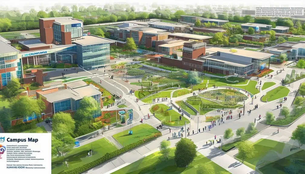
Modern campus maps showcase a user-friendly interface that simplifies locating and interacting with campus facilities effortlessly. When you first access these maps, you’ll immediately notice an intuitive design that prioritizes ease of use. The user interface is carefully crafted to be straightforward and navigable, ensuring you can find buildings, departments, and services without any trouble.
Interactive elements are a standout feature, enhancing both navigation and engagement. These elements allow you to click on different parts of the map to retrieve detailed information about various facilities. For example, you can visualize the location of lecture halls, libraries, and cafeterias with a simple click, which notably improves your understanding of the campus layout.
The integration of interactive elements doesn’t just assist in navigation; it also provides essential information that can impact your decision-making process. Whether you’re a new student deciding which library to visit or a visitor looking for the nearest parking lot, these maps offer the data you need in real-time.
In essence, modern campus maps enhance your user experience by combining a simple, efficient user interface with interactive elements that deliver important information, making your campus exploration both effective and engaging.
Cloud-Based Design

Cloud-based design allows you to access campus maps on any device, eliminating the need for additional hardware. This approach guarantees smooth accessibility, meaning you can view the map on a smartphone, tablet, or computer without any hassle. With the cloud, updates and maintenance are straightforward, leveraging a template-based system that doesn’t necessitate programmer involvement.
One of the standout features is GPS capabilities, which provide precise directions to any location on campus. This is incredibly user-friendly and assures you’ll never get lost. Flexibility is another key advantage; cloud-based maps integrate smoothly with existing maps, making the switch effortless.
| Feature | Benefit |
|---|---|
| Accessibility | Use on any device, no extra hardware needed |
| Updates & Maintenance | Simplified process, no programmer required |
| GPS Capabilities | Accurate directions and easy navigation |
| Flexibility | Works seamlessly with existing maps |
| Customizable Features | Tailor the map to match your institution’s branding and identity |
Customizable features allow you to tailor the map to your institution’s branding and identity. Whether you need to highlight specific buildings or services, the cloud-based design offers unparalleled customization options. The result is a modern, efficient, and user-friendly campus map that meets all your needs.
Customization Options
When you’re customizing your campus map, you can tailor it to reflect your institution’s branding and identity. By adjusting elements like colors, logos, and fonts, you create an interactive user experience that keeps visitors engaged. These customization options not only enhance visual appeal but also maintain design consistency across all your digital platforms.
Branding and Identity
Incorporating customization options into campus maps allows institutions to seamlessly integrate their unique branding elements, creating a cohesive and engaging visual experience for users. By customizing the map to reflect your institution’s identity, you make sure that every element, from colors to logos, aligns perfectly with your brand. This tailored design not only enhances the interactive map but also boosts user engagement by providing a personalized experience.
Customizing your campus map is about more than just aesthetics; it’s about creating a visual narrative that resonates with prospective students and visitors. When users see familiar branding elements, it fosters a sense of connection and trust. A cohesive map design consistent with your institution’s branding can have a significant impact on how users perceive and interact with your campus.
Here’s a quick comparison of branding and customization features:
| Feature | Benefit | Emotional Impact |
|---|---|---|
| Custom Colors | Aligns with brand identity | Familiarity |
| Logo Integration | Enhances brand recognition | Trust |
| Tailored Icons | Personalized navigation experience | Engagement |
| Themed Layouts | Consistency across platforms | Professionalism |
| Custom Fonts | Unique visual style | Uniqueness |
Utilize these customization options to create an interactive map that’s not only functional but also a true extension of your institution’s identity.
Interactive User Experience
Enhancing the interactive user experience in campus maps involves leveraging customizable features that allow users to navigate the campus seamlessly while aligning the map’s design with the institution’s unique identity. By incorporating customization options, you can integrate branding elements such as logos, color schemes, and fonts that reflect your institution’s character. This ensures that the map doesn’t just serve a practical purpose but also reinforces the institution’s brand.
Customization also extends to unique features that make the map more engaging and user-friendly. You can tailor the map to highlight specific landmarks, facilities, or events, making it easier for users to find what they need. A well-crafted, user-friendly design with easy navigation options guarantees that users can effortlessly explore the campus.
The interactive elements of modern campus maps aren’t just functional but also visually appealing. These tailored features create an immersive and engaging experience for prospective students, current students, staff, and visitors. Whether it’s integrating 3D models of buildings or interactive tours, the goal is to make the map as informative and inviting as possible. Essentially, a customized campus map is a powerful tool that enhances the overall user experience.
Media Library Management
Effective media library management is vital for keeping campus maps user-friendly and intuitive, making it easier for users to access relevant multimedia content swiftly. By simplifying media libraries, you can greatly improve the user experience through efficient content organization. Users can quickly locate relevant information, whether it’s an image, video, or document linked to specific locations on the map.
When managing your media library, consider the following:
- Content Organization: Proper categorization and tagging of multimedia content are essential for efficient retrieval. Well-organized libraries ensure users can easily navigate and find what they need without confusion.
- Seamless Integration: Make sure that your media library allows for seamless incorporation of multimedia elements into interactive maps. This enables a cohesive user experience where media elements are readily accessible and enhance the overall mapping experience.
- Content Management Systems (CMS): Utilize robust CMS tools to manage your media library effectively. These systems aid in maintaining and updating multimedia content, ensuring that your campus maps always offer the most current information.
With these practices, you’ll guarantee that your campus mapping system is not only efficient but also engaging for all users.
Accessibility Features

The new campus map tool automatically identifies accessible pathways, closures, and obstacles, providing invaluable assistance to users with mobility challenges. It highlights critical aspects like the operational status of elevators, ensuring you don’t encounter unexpected barriers. The map also marks accessible facilities such as parking spaces and curb cuts, making it easier for you to plan your route efficiently.
Collaboration with the Disability Alliance has played a key role in ensuring the map meets the university’s strict accessibility requirements. This partnership has led to more inclusive and user-friendly features, enhancing usability for all students, faculty, and visitors who rely on the map for navigation.
The development of these accessibility features was a collaborative effort spanning over two years. By incorporating feedback from the Disability Alliance and other stakeholders, the GIS team has created a tool that is both detailed and easy to use. This meticulous process aimed to address the real-world needs of individuals who depend on the map for everyday navigation, thereby greatly enhancing their campus experience.
Real-Time Updates

With real-time updates, you’ll get the most accurate campus information, including construction zones and traffic changes. These dynamic map adjustments guarantee you always have the latest details, so you can navigate efficiently. Live data integration also enhances safety by providing immediate emergency alerts and guidance.
Accurate Campus Information
Thanks to up-to-the-minute updates, you can navigate campus with confidence, knowing construction areas, closures, and obstacles are accurately displayed. Modern campus maps provide you with the latest information on accessible pathways, entries, and parking spaces. This is particularly beneficial for individuals requiring elevator access or those adhering to university accessibility standards.
The GIS team employs template-based updates to simplify maintaining accurate and up-to-date information on the map. Collaborative efforts with the Disability Alliance ensure that the mapping data meets university accessibility standards, offering a comprehensive guide for everyone, including those with disabilities. Having up-to-the-minute updates means unexpected changes, like sudden construction or temporary closures, are reflected immediately, allowing you to plan your route effectively.
Here are three key features that enhance your campus navigation experience:
- Up-to-the-Minute Construction Notices: Instantly see areas under construction to avoid delays and reroute efficiently.
- Accessible Pathways: Find the most navigable routes, ensuring adherence to university accessibility standards.
- Elevator Status: Check the operational status of critical elevators, aiding those who depend on elevator access.
This detailed and user-friendly approach makes campus navigation straightforward and stress-free.
Dynamic Map Adjustments
You’ll appreciate the way modern campus maps use real-time updates to keep you informed about construction areas, traffic rerouting, and other dynamic changes. These dynamic map adjustments mean you’ll always have accurate information at your fingertips, allowing you to navigate the campus efficiently. Real-time updates guarantee that the data reflects current conditions, so you can trust that the information provided is reliable and precise.
The implementation of template-based designs simplifies the maintenance process, enabling the GIS team to make swift adjustments as necessary. When a new construction site emerges or a pathway is temporarily closed, the map is promptly updated, minimizing confusion and inconvenience. This approach ensures that the campus community can rely on the map for accurate guidance.
Behind these dynamic adjustments is a collaborative effort involving various campus departments. This teamwork improves usability and secures the map meets the needs of everyone on campus. By integrating feedback from students, faculty, and staff, the map becomes a more user-friendly tool. Ultimately, these real-time updates and collaborative efforts enhance the overall user experience, making campus navigation seamless and efficient.
Wayfinding and Events

Interactive campus maps revolutionize wayfinding and event management by providing real-time guidance, accessible route options, and dynamic multimedia elements that enhance the overall user experience. With interactive maps, event guidance becomes seamless, especially with real-time updates on construction and traffic rerouting, guaranteeing that you and other event attendees can reach your destinations without unnecessary detours.
Here’s how interactive maps improve your event experience:
- Real-Time Updates: Get instant notifications about any construction, traffic changes, or other disruptions, allowing you to adjust your route on the fly.
- Multimedia Elements: Engage with videos, virtual tours, and other multimedia features that make navigating the campus more intuitive and enjoyable, creating a dynamic event experience.
- Accessible Routes: Highlighting accessible facilities and routes ensures that everyone, including the 15% of the global population with disabilities, can find their way around the campus comfortably.
These maps also reduce confusion and stress by providing clear, real-time guidance and directions. For event management, they simplify logistics, from parking planning to building safety features, and streamline data management for facilities and digital teams. Embrace the ease and efficiency that interactive maps offer, guaranteeing a smooth and engaging event experience for everyone involved.
Showcasing Facilities

Building on the advantages of real-time event management, modern campus maps also excel in showcasing the diverse range of facilities available to visitors and guests. These maps highlight building status, ensuring you know which facilities are open, closed, or under maintenance. They also mark construction areas clearly, providing a heads-up to avoid any potential disruptions.
Future development plans are another feature you’ll appreciate, allowing you to see what’s coming next on campus. For those involved in event planning, on-campus housing options are easily displayed, making visitor convenience a priority. You can find lodging options tailored to various events, ensuring guests have a comfortable place to stay.
Event-specific map layers further enhance the usability of campus maps. These layers can help you navigate large events, pinpointing exactly where campus-sponsored housing and other essential facilities are located. By offering a detailed overview, these maps serve as indispensable planning tools, helping you make the most of your visit or event.
Whether you’re a visitor exploring the campus or an organizer planning an event, campus maps provide all the information you need about facilities and housing options, ensuring a seamless experience.
Conclusion
Incorporating modern features into campus maps isn’t just about aesthetics; it enhances user experience greatly. Did you know that 85% of students rely on digital maps to find their way around campus events and facilities? With user-friendly interfaces, real-time updates, and robust accessibility options, today’s campus maps are indispensable tools. They offer unparalleled customization and media management, ensuring everyone can find their way effortlessly. Embrace these advancements to make exploring your campus a seamless experience.
Frequently Asked Questions
Why Are Campus Maps Important?
Campus maps are important because they provide real-time navigation, guarantee safety, and offer updates on construction areas. You’ll find accessible routes, multimedia elements, and self-guided tours, enhancing user experience and promoting the campus environment.
What Is a Map Campus?
So you’re wondering what a campus map is? It’s just a simple digital layout of a college, helping you find your way around. Except, now it’s packed with videos, audio, and interactive features for maximum engagement.


