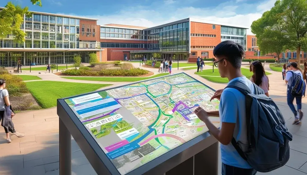
The best interactive campus maps offer robust features like zoom, filter options, and GPS integration for precise navigation. They provide real-time updates on parking and shuttle locations, reducing stress and optimizing your visit. Accessibility features such as screen reader compatibility and spatially focused resources like gender-neutral restrooms enhance inclusivity. Integrate public transport data and sustainable navigation for a thorough experience. Customize maps with layers, real-time webcams, and 360° views to highlight unique campus aspects. These maps boost user engagement and optimize multi-campus navigation, making them indispensable for today’s universities. Continue below to explore these dynamic solutions further.
Key Takeaways
- Real-time updates on parking availability and shuttle locations optimize campus navigation and user experience.
- Accessibility features like screen reader compatibility and keyboard navigation ensure inclusivity.
- Customizable map solutions with layer selection, category filters, and personalized branding enhance user engagement.
- Integration with co-curricular activities and events keeps the campus community informed and involved.
- Multi-campus navigation provides a unified interface for exploring different campus sites efficiently.
Top Features of Campus Maps

With interactive campus maps, you’ll find top features like zoom, filter options, and GPS integration that greatly enhance navigation and user experience. These maps offer real-time updates on parking availability and shuttle locations, ensuring you always have the most current information at your fingertips.
Interactive campus maps also incorporate accessibility features such as screen reader compatibility and keyboard navigation, creating an inclusive environment for all users. These features make it easier for individuals with disabilities to navigate the campus effortlessly. Additionally, inclusive resources like gender-neutral restrooms and lactation rooms are prominently highlighted, promoting diversity and equity.
Integrating public transport options and sustainability initiatives on these maps showcases the university’s commitment to environmental responsibility. You can easily locate bus stops, bike-sharing stations, and electric vehicle charging points, making it convenient to choose eco-friendly transportation methods.
Virtual Tours for Engagement
Utilizing the robust features of interactive campus maps, virtual tours offer an immersive experience that keeps prospective students and visitors highly engaged. By incorporating virtual tours, universities like Bradley University and Santa Monica College provide interactive content and filters, allowing users to explore specific areas of interest. This enhances user engagement by offering a personalized experience tailored to individual preferences.
Branded campus maps, as employed by institutions such as D’Youville College and Southeast Technical College, further enhance user experience. These maps integrate school colors, logos, and themes, creating a unified visual identity that connects with users. When you navigate these maps, the visual consistency reinforces the brand, making the tour more memorable and engaging.
Modern Campus offers custom campus map software tailored specifically for higher education institutions. These maps include descriptive content, directions, and program integration, all designed to enrich your virtual tour experience. Additionally, accessibility layers guarantee that everyone can navigate the campus with ease, although we’ll explore that further in the next subtopic.
Accessibility and Inclusivity

Interactive campus maps equipped with accessibility features like screen reader compatibility and keyboard navigation guarantee that everyone can explore the campus with ease. By embedding these accessibility features, you make sure that students with disabilities can navigate seamlessly, fostering a sense of inclusivity. For instance, screen reader compatibility allows visually impaired students to receive audio descriptions of map details, while keyboard navigation supports those with motor impairments.
Highlighting campus resources such as gender-neutral restrooms and lactation rooms on your interactive map further promotes diversity and equity. It is crucial to ensure these inclusive resources are easily identifiable. This not only aids users in finding essential facilities but also underscores the institution’s commitment to a welcoming environment.
By connecting a diverse user base to relevant campus resources, your interactive map can greatly enhance the student experience. Include markers for accessible entrances, elevators, and other facilities that cater to specific needs. This spatially-focused approach guarantees that every student, regardless of ability, can access the necessary amenities.
Emphasizing accessibility and inclusivity through your interactive map contributes to a positive experience for all students. It is a critical step in building a campus environment that values every individual and their unique needs.
Customizable Map Solutions

Customizable map solutions let you tailor the user experience with advanced features like layer selection, category filters, and personalized branding. These maps can display specific program listings and campus highlights, enhancing user engagement. By integrating 360° views and videos, you can create a unique and immersive wayfinding experience.
Tailored User Experiences
You can personalize your campus navigation by selecting specific categories, filters, and overlays, ensuring the interactive map highlights only the features most relevant to you. This interactive mapping approach leverages tailored user experiences to maximize efficiency and engagement. Here’s how customizable map solutions can cater to your unique needs:
- Categories: Choose from academic buildings, residence halls, dining options, parking lots, and recreational areas. This customization option helps you quickly locate the campus features you use most frequently.
- Filters: Apply filters to narrow down search results based on user preferences, such as accessibility, operating hours, or amenities. Filters enhance the precision of your search, making it easier to find exactly what you need.
- Overlays: Utilize overlays to view additional data layers like Wi-Fi hotspots, emergency stations, or upcoming events. These overlays provide a richer spatial context and help you plan your campus activities more effectively.
- User Preferences: Save your preferences for future use, ensuring that the map consistently aligns with your specific interests. This feature streamlines your experience, reducing the time spent adjusting settings each time you use the map.
Advanced Customization Features
Universities can utilize advanced customization features to seamlessly integrate branding elements, color schemes, and specific design choices into their interactive campus maps, guaranteeing these tools reflect the institution’s unique identity and culture. With customizable map solutions, you can emphasize unique campus features such as historic buildings, green spaces, or state-of-the-art facilities. These features enable you to highlight the distinctive aspects that define your university.
Interactive maps can be tailored to include specific locations, amenities, and points of interest that are vital to your campus community. By integrating filters, categories, and layers, you enhance user experience and engagement, making it simpler for students, staff, and visitors to navigate and explore the campus. Advanced customization allows you to create a map that not only operates efficiently but also embodies your university’s values and culture.
Personalization options guarantee that your interactive map solution mirrors key attractions and core values, positioning your institution as innovative and student-friendly. By concentrating on advanced customization, you’ll be able to design a map that is both visually appealing and functionally robust, ultimately strengthening your university identity and enhancing the overall campus experience.
Real-Time Data Integration
You can transform your campus map into a dynamic tool by integrating real-time data like live parking availability and shuttle tracking. With instant updates on campus activities and access to live webcams, users stay informed and engaged. This real-time integration not only enhances user experience but also spatially optimizes campus navigation.
Live Parking Updates
Access to live parking updates on interactive campus maps provides real-time data on parking availability, enabling users to plan their campus visits with precision and efficiency. By integrating real-time data, these maps allow you to access current parking status, reducing the time spent searching for a spot and minimizing frustration. This technological feature greatly enhances visitor satisfaction and streamlines the parking process for everyone on campus, from students and staff to visitors.
Here are four key benefits of using interactive campus maps with live parking updates:
- Increased Efficiency: Real-time data integration provides up-to-the-minute information on parking availability, helping you make informed decisions quickly.
- Reduced Stress: Knowing where to find available parking before arriving reduces the stress and uncertainty often associated with campus visits.
- Improved Traffic Flow: By directing vehicles to available parking spots, these maps help alleviate congestion and improve overall traffic flow on campus.
- Enhanced Visitor Experience: Offering accurate parking information boosts visitor satisfaction, making campus visits smoother and more enjoyable.
Incorporating live parking updates into interactive campus maps not only optimizes your visit but also contributes to a more efficient and welcoming campus environment.
Dynamic Campus Activities
Interactive maps with dynamic data integration transform the way you navigate campus activities by providing real-time updates on events, shuttle locations, and parking availability. By incorporating real-time data integration, these maps ensure you’re always in the loop with dynamic campus activities. You can access live updates on campus events, ranging from academic lectures to social gatherings, directly on your device.
With interactive maps, user engagement soars as you receive current information about what’s happening around campus. Imagine knowing exactly when and where a guest lecture or club meeting is taking place, all thanks to live updates. These maps also seamlessly integrate with other campus services, providing real-time access to shuttle locations and parking availability.
For a more immersive experience, some interactive maps even feature live webcam feeds. You can view bustling campus hotspots or serene study areas, enhancing your spatial awareness and planning. Overall, the implementation of real-time data integration in interactive maps offers a thorough and up-to-date navigational tool that keeps you informed and engaged with all dynamic campus activities. Whether you’re a student, faculty, or visitor, these maps elevate your campus experience to a whole new level.
Real-Time Shuttle Tracking
Real-time shuttle tracking revolutionizes campus transportation by providing precise, up-to-the-minute data on shuttle locations and arrival times. You can see exactly where shuttles are in real-time on interactive campus maps, allowing you to plan your commute effectively and reduce wait times. This real-time data integration guarantees that shuttle arrival times are accurate, helping you navigate campus more efficiently.
Here’s how real-time shuttle tracking enhances your seamless transportation experience:
- Accurate Shuttle Locations: Interactive campus maps give you the precise location of shuttles, so you know when to head to the stop.
- Reduced Wait Times: By tracking shuttle movements in real-time, you can minimize the time you spend waiting, making your commute smoother and more predictable.
- Effective Commute Planning: With precise shuttle arrival times, you can schedule your day more efficiently, avoiding unnecessary delays.
- Enhanced User Experience: Real-time data integration on campus maps provides up-to-date information, offering convenient navigation options and improving overall transportation efficiency.
These features of real-time shuttle tracking on interactive campus maps not only enhance your daily commute but also contribute to a more streamlined and efficient campus transportation system.
Multi-Campus Navigation

Switching between different campuses within a university system becomes intuitive with multi-site navigation on interactive maps, allowing users to view detailed spatial data and facility information seamlessly. By integrating multiple locations into a single, unified map interface, you can easily access all-encompassing information about each campus’s facilities and amenities.
Multi-site navigation is essential for universities with multiple sites, providing a unified view that enhances understanding of the entire university system. You can quickly switch from one campus to another, exploring buildings, classrooms, libraries, and recreational centers without any confusion. This functionality is particularly beneficial for new students, visiting faculty, or guests who need to navigate unfamiliar terrain efficiently.
Interactive maps with multi-site navigation streamline your experience, offering a user-friendly way to explore and understand complex university layouts. You’ll find it easier to locate specific amenities, such as dining halls, gyms, or study areas, and plan your visits accordingly. Additionally, these maps can update in real-time, ensuring that you always have the latest spatial data at your fingertips.
Integration With Co-Curricular Activities

Building on the ease of exploring multiple campuses, integrating co-curricular activities into interactive campus maps enhances student engagement by providing detailed, spatially-organized information on clubs, sports facilities, and event venues. These maps offer a holistic college experience by allowing you to easily discover and participate in extracurricular opportunities.
Interactive campus maps can highlight various co-curricular activities, making it easier for you to find and get involved in what interests you. Here’s a breakdown of how these features can benefit you:
- Club Locations: Easily locate and get directions to student organizations and club meeting spots.
- Sports Facilities: Find gyms, fields, and courts, ensuring you’re always in the loop about athletic resources.
- Event Venues: Automatically update with information on upcoming events, so you never miss an opportunity to engage.
- Community Service Initiatives: Pinpoint volunteer opportunities, enhancing your contribution to the community.
Enhancing Student Recruitment and Retention
By leveraging interactive campus maps, universities can enhance student recruitment and retention through engaging virtual tours and detailed navigation of campus amenities. Interactive campus maps play a pivotal role in capturing prospective students’ interest by showcasing the campus’s unique offerings. These maps provide immersive, virtual tours that allow students to explore facilities, residence halls, and key landmarks from anywhere in the world.
Custom campus map software, like that provided by Modern Campus, tailors these tools to meet the specific needs of higher education institutions. With features like filters and layers, students can easily navigate different areas of the campus, exploring specific departments, student centers, and dining options. This detailed navigation aids in student retention by helping current students find resources and amenities that enhance their college experience.
Accessible and visually appealing map designs, such as those implemented by Riverside City College, improve engagement through inclusive navigation options. The detailed information on programs, facilities, and resources available through these maps ensures students feel connected and supported. Ultimately, by effectively utilizing interactive campus maps, universities can notably enhance their student recruitment and retention strategies, making the campus environment more inviting and navigable for all.
Conclusion
You’ve explored the best features of interactive campus maps, from real-time data integration to multi-campus navigation. Did you know that universities with dynamic, interactive maps see a 20% increase in campus tour participation? These maps don’t just guide; they engage and inform, making campuses more accessible and inclusive. Integrating co-curricular activities and customizable solutions enhances student recruitment and retention. Embrace these technologies to create a seamless, informative, and engaging campus experience.
Frequently Asked Questions
What Is a Map Campus?
A campus map is a detailed visual layout of a university, highlighting buildings, key locations, and facilities. It aids navigation for students, visitors, and staff, enhancing accessibility and spatial awareness through thorough, data-driven visual representations.


