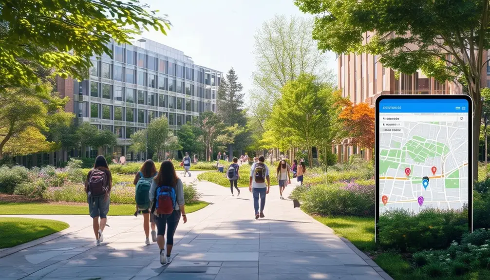
Real-time updates in campus maps drastically improve direction, safety, and resource management. Universities like Rice integrate live transit feeds, enhancing transit efficiency and commute planning. Live cameras, used at Michigan Tech and the University of Mississippi, decrease wait times by 30% and boost safety by 20%. Penn State offers lab usage data, while Arizona State provides live parking updates to ease event congestion. Accessibility features, ensuring ADA compliance, guide users around closures on campus. These updates make finding your way around campuses more efficient and secure, enhancing your experience and providing critical, real-time information. Discover how these features can transform your campus journey.
Key Takeaways
- Live camera feeds provide real-time updates on campus facilities and activities.
- Integration of live transit feeds improves transportation planning and accessibility.
- Real-time updates enhance campus navigation and resource management.
- Continuous surveillance from live cameras boosts safety and security.
- Real-time data on computer lab usage and parking availability aids efficient campus operations.
Live Data Integration Examples

Universities like the University of Mississippi frequently integrate live data feeds, such as 14 live feed cameras, to enhance campus safety and security. This live data integration provides real-time updates on various aspects of campus life, notably improving the overall efficiency and well-being of the university community.
At Michigan Tech University, live camera feeds monitor campus activity and events in real-time, ensuring prompt responses to any incidents or emergencies. This integration of live data is essential for maintaining campus security. Similarly, Rice University offers campus-wide transit information through live feeds, aiding students and staff in planning their commutes more effectively. The ability to access up-to-date information on transit schedules and delays directly impacts the daily routines of the university population.
Penn State utilizes real-time updates to showcase computer lab usage, allowing students to see which labs are available at any given moment. This not only optimizes resource management but also enhances the user experience by reducing wait times and increasing accessibility. Additionally, Arizona State University improves the visitor experience by providing live parking information during events, ensuring that guests can find parking spaces with ease. This integration of live data feeds into campus maps greatly boosts the operational efficiency and user experience across universities.
Benefits of Live Cameras
By integrating live cameras into campus maps, you greatly enhance both safety and convenience. Students can quickly find the shortest lines at facilities, reducing wait times by up to 30%. Additionally, real-time camera feeds help manage traffic flow, thereby increasing overall campus safety by 20%.
Enhancing Campus Safety
Leveraging live cameras on campus greatly enhances safety measures by providing continuous, real-time surveillance of activities. These cameras offer a significant advantage by delivering real-time updates that improve the overall campus safety. They allow you to monitor traffic flow and observe busy areas, ensuring that any unusual or suspicious activity is promptly identified and addressed.
Live cameras serve as a deterrent for potential criminal activities, as the presence of surveillance creates a heightened sense of security. You can also rely on these live feeds to manage emergency situations more effectively. For instance, in case of an incident, security personnel can immediately access real-time footage to assess the situation and coordinate a swift response.
Real-time updates from these cameras help in optimizing campus operations. By tracking traffic flow and student movement patterns, campus authorities can make informed decisions about resource allocation and crowd management. This proactive approach not only enhances safety but also improves the efficiency of campus facilities.
Student Convenience Boost
Live cameras provide students with real-time updates on campus facilities, helping them find the shortest lines and navigate efficiently. By integrating live camera feeds into your campus maps, you can benefit from a powerful navigation tool that enhances student convenience. You’ll be able to check traffic flow at busy dining halls, libraries, and parking lots, thereby minimizing wait times and maximizing your productivity.
An interactive map enriched with live camera feeds transforms how you experience the campus. It allows you to see points of interest, such as event locations and popular study spots, providing you with a holistic view of the campus community. This real-time information doesn’t just improve your daily routine but also helps in emergencies, offering you the latest updates on any disruptions or hazards.
For prospective students, live cameras offer an authentic glimpse into campus life, aiding in their decision-making process. They can explore various aspects of the campus remotely, making them feel more connected even before they arrive. Additionally, the presence of these cameras enhances safety and security measures, contributing positively to the overall campus environment.
Importance of Live Transit Feeds
You can greatly enhance your commute planning efficiency with live transit feeds, providing real-time bus tracking and arrival times. These feeds offer enhanced geographic context, allowing you to understand the spatial dynamics of campus more effectively. This not only aids in navigation but also boosts overall campus accessibility.
Real-Time Bus Tracking
Real-time bus tracking provides students and staff with accurate, up-to-the-minute information on bus arrival times, greatly enhancing campus transit efficiency. By leveraging interactive maps and live transit feeds, you can effortlessly monitor the movement of buses across campus, ensuring you never miss a ride. This integration significantly boosts campus navigation, allowing you to pinpoint exact bus locations and predict arrival times with remarkable accuracy.
Utilizing real-time bus tracking not only minimizes your waiting periods but also maximizes your ability to navigate campus effectively. The live transit feeds offer a detailed view of bus routes, aiding in the understanding of the geographic context and improving overall campus accessibility. Whether you’re heading to a lecture or returning to your dorm, knowing the precise bus schedules means you can plan your movements better and avoid unnecessary delays.
For students and staff alike, live transit information translates to a smoother, more predictable transportation experience. With the ability to see buses in real-time, you can make informed decisions about your commute, ultimately optimizing your time and enhancing your daily campus experience. Real-time bus tracking truly revolutionizes the way you navigate campus.
Commute Planning Efficiency
Efficient commute planning hinges on leveraging live transit feeds that provide real-time bus arrival information, enhancing your ability to navigate campus with precision. By accessing interactive maps equipped with real-time updates, you can optimize your travel routes, minimizing wait times and maximizing effectiveness. For public transportation users, these live feeds are a game-changer, allowing you to track bus movements and plan your departure times accurately.
Real-time updates foster commute planning efficiency by offering immediate insights into bus locations and expected arrival times. This data-driven approach means you no longer have to rely on static schedules that might not reflect current conditions. Instead, you can make informed decisions about when to leave and which routes to take, ensuring you reach your destination on time.
Integrating live transit feeds into campus maps significantly enhances overall campus accessibility. You can easily identify the nearest bus stops, check the status of incoming buses, and adjust your plans accordingly. This seamless navigation experience is particularly beneficial during peak hours when public transportation demand is high. By leveraging these real-time tools, you enhance your ability to move efficiently across campus, making your daily commute less stressful and more predictable.
Enhanced Geographic Context
Incorporating live transit feeds into campus maps provides an enriched geographic context by offering real-time data on bus locations and arrival times, thereby improving direction and transportation planning. When you access an interactive campus map with live transit feeds, you can see the precise location of buses and their estimated arrival times. This data is vital for students and staff who need to plan their commutes efficiently.
By integrating live transit feeds, the map offers a dynamic view of campus transportation. You can track bus schedules and routes in real-time, which significantly enhances campus accessibility. Knowing the real-time bus arrival times allows you to make informed decisions about when to leave and which routes to take, reducing the uncertainty often associated with public transportation.
Additionally, public transportation users will find finding their way around the campus much easier. The enriched geographic context provided by live transit feeds ensures you’re always aware of the nearest bus stop and the next bus’s arrival time. This leads to more efficient transportation planning and better utilization of campus resources. Ultimately, real-time transit information transforms the interactive campus map into a powerful tool for enhancing your overall campus experience.
Diverse Live Data Options

By leveraging diverse live data options, campuses can enhance navigation and resource management through tailored, real-time integrations. An interactive campus map offers real-time updates that improve campus navigation to a great extent. For instance, Penn State’s live data feeds show real-time computer lab usage, allowing students to locate available workstations efficiently. Similarly, Arizona State University provides detailed parking information during events, helping visitors find parking spaces quickly and reducing congestion.
The integration of ESRI data further enriches the user experience by offering detailed geographic information, making navigation more intuitive. These diverse live data options aren’t just limited to computer labs and parking. They can span across various needs, from showing library occupancy to tracking shuttle bus locations, ensuring that users have access to the most current information.
Such live data integration can be tailored to address specific campus needs, providing customized solutions that enhance overall resource utilization and user satisfaction. With endless possibilities for integration, campuses can create a dynamic, responsive environment that evolves in real-time, making the campus experience smoother and more efficient for everyone involved. By implementing these advanced features, you can create a more connected and informed campus community.
New Accessibility Features

The new accessibility features on the campus map identify accessible pathways and route users around obstacles such as closures and construction sites. These enhancements streamline navigation for individuals with mobility challenges by displaying crucial information like accessible entries, parking spaces, and the operational status of elevators. The user experience improvements were meticulously developed over two years, ensuring the map meets the specific needs of those relying on its accessibility features.
Back-end changes have revolutionized how the GIS team maintains the map, facilitating seamless updates without requiring programmer intervention. This guarantees the map remains accurate and up-to-date, greatly enhancing its reliability. The accessible pathways and obstacle notifications are designed to provide real-time, data-driven insights, making campus navigation more efficient and stress-free.
You’ll find that user feedback is highly encouraged to continually refine these features. Contacts are readily available for inquiries and assistance related to accessibility in Blacksburg, Va. By incorporating your feedback, the campus map will continue to evolve, offering an increasingly user-friendly navigation experience for everyone. These thoughtful, data-rich features underscore the commitment to making the campus more navigable and inclusive for all users.
Real-Time Accuracy and Updates
Thanks to up-to-the-minute updates, the campus map at Virginia Tech now provides highly precise navigation information directly to users. The map development project has incorporated substantial back-end modifications, allowing the GIS team to perform updates without needing a programmer. This template-based system guarantees that the map remains current and accurate, enhancing user experience to a great extent.
The collaborative efforts, which spanned over two years, included input from the ADA campus accessibility architect, ensuring the map meets the diverse needs of the campus community. The real-time precision of the map allows users to navigate the campus efficiently, and your feedback is essential for ongoing improvements. You’re encouraged to share your experiences and suggestions at [email protected].
| Feature | Benefit | Contact for Feedback |
|---|---|---|
| Real-Time Precision | Reliable navigation | [email protected] |
| Back-End Modifications | Easier updates by GIS team | Angela I. Correa |
| Template-Based | No programmer involvement needed | Kit Hayes |
| ADA-Compliant Development | Accessibility-focused design | Angela I. Correa, Kit Hayes |
| User Feedback Integration | Continuous improvement | [email protected] |
Conclusion
Imagine walking across campus, your phone guiding you with pinpoint accuracy, showing live camera feeds and transit updates. You never miss a bus or struggle to find an accessible route. Real-time data integration transforms your campus experience, ensuring you’re always informed and efficient. With diverse live data options, every step you take is optimized. Embrace this digital evolution, where technology seamlessly enhances navigation and accessibility, making your campus journey smoother and smarter.


